
Canaima
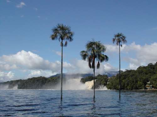
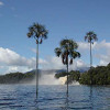
One of the most beautiful places in Venezuela is Canaima lagoon and its surroundings. The lagoon is fed by several small water falls: Hacha, Wadaima, Golondrina and Ucaima. On the back you can see 3 "tepuy", those flat top mountains, that distinguish this region, they are called Nonoy-Tepuy ("Zamuro" or Vulture), Kuravaina-Tepuy ("Venado" or Deer) and Topochi-Tepuy ("Cerbatana" or Blowpipe).
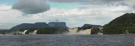
Canaima lagoon
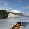
You can enjoy the navigation in a "Curiara" - those long canoes used by Indians - and a closer view to the water falls.
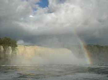
Golondrina (swallow) fall
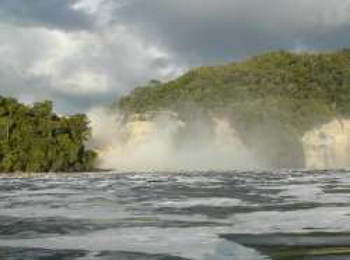
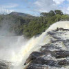
Hacha (ax) Fall
Something really surprising is the color of the water and the sand. Due to the abundance of minerals, the water takes a red color and the sand has a beautiful light pink, because of the presence of quartz.
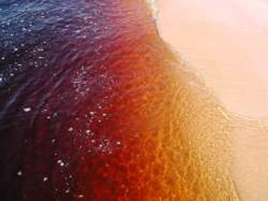
Red water and pink sand
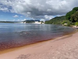
Canaima's beach
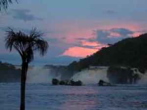
Sunset in the lagoon
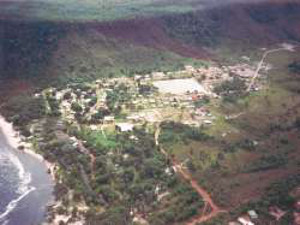
The village near Canaima
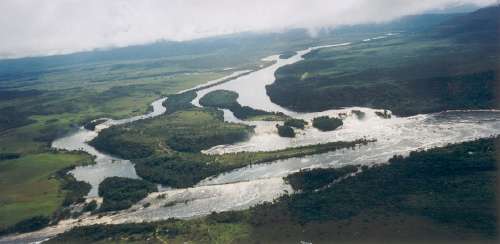
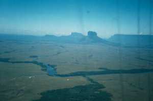
In the aerial view shown below, you can appreciate how the Carrao river, after bording the Auyantepuy, and being fed by water coming from the Angel Falls, splits in several streams, and forming islands. The biggest island is called Anatoly. To the left, if you pay close attention, you can see the Sapo and Sapito Falls. To the right the same water falls that we have shown before, feeding the Canaima Lagoon. Below the Ara fall, where the lagoon ends.
To explore every corner of Canaima, please visit our:
Interactive map
Excursions from Canaima
You can (and should) take a "curiara" and have a closer look to Canaima waterfalls and reach the island Anatoly, from where you can see the Sapo (frog) and Sapito (little frog) falls. You will never forget the experience of walking underneath "El Sapo", on your way to "El Sapito".
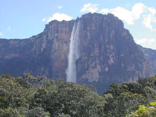
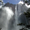
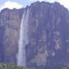
And of course, you can't miss the higher water fall and one of the natural wonders of the world: the Angel Falls.
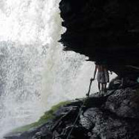
You can get there by air or navigating upstream the Carrao and then the Churun rivers. It is a long ride (3 hours and a half) and an hour walk that will take you to the base of the falls, where this picture was taken. But be reassured, you will enjoy the trip from beginning to end.
Plan of Canaima
1 - Salto Sapito
2 - Salto El Sapo
3 - Salto Ara
4 - Salto Hacha
5 - Salto Wadaima
6 - Salto Golondrina
7 - Salto Ucaima
8 - Playa de los Enamorados
9 - Caserío Kaunwaripa
10 - Inparques
11 - Campamento Edelca
12 - Camino Indígena
13 - Petroglifos
14 - Terminal de Pasajeros
15 - Inparques
16 - Ambulatorio
17 - Iglesia
18 - Escuela
19 - Aldea Maloka
20 - Iglesia Pemón
21 - Pista aterrizaje Ucaima
22 - Puerto Ucaima
23 - Playita
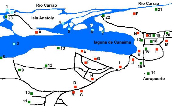
A - Bernal Tours
B - Posada Kusari
C - Posada Kaikuse
D - Restaurante Parakaupa
E - Tiuna Tours
F - Makunaima
G - Canaima Tours
H - Campamento hnos. Jiménez
I - Quincalla Canaima Souvenirs
J - Tienda Salto Angel
K - Campamento Hoturvensa
L - Posada Wey Tepuy
M - Restaurante Simon
N - Kamaracoto Tours
O - Kaikarwa Tours
P - Campamento Ucaima
Fotos out of the car's window
Río Carrao Foto: Nelly Chacón
Ver además
| Paquetes Canaima-Salto Angel 2024 / 2025 - La mejor relación precio-valor, para ir a Canaima y desde allí al Salto Ángel (Kerepakupai Merú) . También puedes hacer excursiones a las cuevas de Kavac en Gran sabana y más. |
| Paseo al Salto El Sapo - Una de las excursiones más inolvidables que se pueden hacer desde la Laguna de Canaima es esta, al Salto El Sapo. Lo verás desde arriba, desde el lado y ˇdesde abajo! |
Camps in Canaima - In Canaima there are many ways to spend the night and spend a good time, without mentioning that the food is excellent. On this page we name the most important hotels, inns and camps of the place. |
| Canaima: Sapo and Sapito falls - Very near from Canaima Lagoon, from a branch of the Carrao river, you will find one of the most beautiful waterfalls in all the region: The Sapo (Frog) Fall. The amount of water is really impressive, specially in the rainy season (May to November). | |
| Angel Falls - In the western part of Canaima National Park, is the Auyantepuy, one of the largest and better known "tepuy" (A flat top mountain ending with vertical walls). From this tepuy is where the Angel falls are formed. The fall is 979 meters high (around 3000 ft |
| Excursión al Salto Ángel - Ir navegando desde Canaima hasta el Salto Ángel es una experiencia inolvidable. Aquí te mostramos lo que puede ser esta experiencia, con fotos y videos del recorrido |
Fin Espacio Publicitario